|
|
||
|
The
Ghost Town Of Croom sits in the large state forest in Florida. It was a
little agricultural town that had a saw mill, Railroad Bridge, Turpentine
Camps, Sugar Mill, and various residences. Back in the 1800s their was an
increase of phosphate mining in the area their were 2 settlements one
called Croom the other one called Oriole. The town of Croom sat between a
Rail Road switch out right where the train tracks split into a Y. Back in
the day the very haunted town of Brooksville residents would take the
short train ride out to Croom and go swimming under the old Iron RR
Bridge. Also settlers would take a ferry which the town boasted. People
would get off the ferry where the the caretaker had a home the only thing
remaining is the pumphouse which was on the opposite side of the river
called Hog Island.
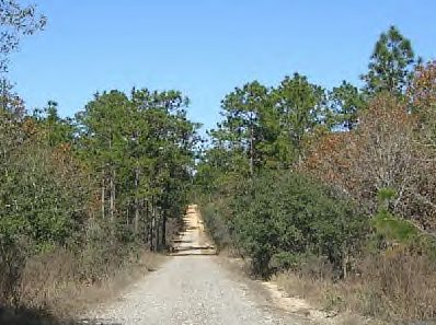
In 1915-1916 a flu epidemic wiped out both ghost towns almost completely and Croom became a ghost town. Croom had a cemetery which was erected in the 1800s hidden deep in the woods which is actually off one of the trails. That cemetery is said to have many settlers buried here who died of such plagues including some civil war soldiers. All that was left behind of the ghost town was a broken RR Trestle, The Thomas House, A Brick Sugarmill Vat, Pump House, Croom Cemetery, a Stone Foundation, and supposedly other numerous foundations. We were not able to find anything left from the ghost town. The area is very sub tropical dozens of trails and heavy brush. One of the trails we hiked on had trees blocking its path and we had to climb under them to continue. The area can get very confusing since it sits in the 3rd largest state forest in the State of Florida. Since their was an increase in phosphate mining activity in the area it convinced a railroad entrepreneur Henry Plant to extend his existing line from Tampa to Croom then northward to Inverness to join up with Silver springs, Ocala and the Gulf Railroad. This would complete the west coast route. In 1902 the name of the line was changed to the Atlantic Coast Line then in 1967 the Seaboard Coast line and then in 1980 the CSX Transportation Line. In the 1960 many railroad lines were abandoned cause their was not a need for them like a century ago when people depending on them to travel to various settlements. Many rail corridors shut down all over the country including the 46 mile right of way between Citrus Springs and Owensboro Junction. This line owned by CSX was purchased under the Florida Rails To Trails Program was one of the first and the gulf coast line was no more for this corridor. The 46 mile corridor was turned into a bike and hiking trail We found this out fairly quickly upon our arrival. Although mining continued till the 1950s all that remains today is the pits, abandoned mines and quarries which are said to be along this corridor. The Withlacoochee State Forest was acquired by the federal government from private landowners between 1936 and 1939. It was eventually divided into 8 tracts. Where we hiked was the Croom Tract which is roughly 4 square miles then their are other tracts which border it so their is roughly over 100,000 acres to the area and many various trails which can get quite confusing unless you stay on the rail corridor. In 1956 the state purchased the land to make it a state forest. But the area became a tourist spot back in the 1970s when Disney World opened so the land was increased so that many horseback riders, hikers, and mountain bikers could enjoy this place of natural beauty. Today bobcats, feral hogs, otters, turkeys, deer, snakes, birds, gopher tortoises, armadillos and many more animals roam these woods. If you were to kept traveling up the path it winds along many streams, a river, lake Henderson, and even stops near the Inverness Train Depot. So as you can see their is ALOT to the area. Its not a place to be taken lightly their is alot of woods and alot of people go four wheeling back here enjoying the sand pits. I am not sure if we will take on board a second investigation on here. We did alot of hiking covering miles of the Croom tract and we were unable to find any remnants of the ghost town which was disappointing. But despite that we did not find any physical structures it does not change the fact that other things lurk deep within the forest just watching quietly. Their are many ghost towns in the state of Florida unfortunately very little remains but the dearly departed. What causes such towns to be wiped out is it disease? Harsh Locations? Terrible Weather? Or is it just man kinds own ignorance? This is a very eerie area the native American people used this land to hunt and the Seminole Warriors use to walk its trails. Today all that is left is nature and miles of forest anything can be out their! If anybody can give us a historical tour of the area maybe show us some sites we would love to camp out here or pull of a second trip out to this location. � By Rick-AngelOfThyNight In accordance with Title 17 U.S.C. Section 107, any copyrighted work in this��message is being distributed under fair use without profit or payment to those��who have expressed a prior interest in receiving the included information for��non-profit research and educational or criticism purposes only.� Notwithstanding��the provisions of sections 106 and 106A, the fair use of a copyrighted work, including such use by reproduction in copies or�phone�� records or by any other means specified by that section, for purposes such as criticism, comment, news reporting, teaching (including multiple copies for classroom use), scholarship, or research, is not an infringement. Anotherwards a few photos are borrowed we do not make any profit off pictures mainly they are used for historical, criticism, theories and other educational purposes therefore we can use them as long as we do not claim them as our own or get paid for those photos specifically.
|
||
|
|
|